
Sinkholes typically occur in humid climates with limestone bedrock, where rainfall dissolves the limestone over time, leading to the collapse of the overlying rock into the void. They are less expected in arid country, where limestone is resistant to weathering.
Other rocks can dissolve over time, however, and they can also cause sinkholes. The mineral gypsum, in particular, is soluble in water and common in some sedimentary rocks. Under the right conditions, it can be dissolved out by groundwater to create a void that then collapses. That is what's happened here. Also called the Littlefield or Beaver Dam sinkhole, after nearby villages, this spectacular collapse feature occurs in sediments on the eastern flank of the Beaver Dam Mountains.
The sinkhole probably formed as groundwater flowed down to Beaver Dam Wash, a tributary to the Virgin River coming in from the north. The sinkhole is in basin-fill sediments which in this area are known to be rich in gypsum locally. Other sinkholes occur in the general area, including Devils Throat in Gold Butte National Monument some 40 miles to the south.
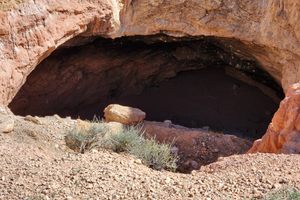
Unlike many sinkholes the walls of Cedar Pocket Sinkhole have partly collapsed, the west side having fallen in to form a steep slope leading to the bottom. This provides problematic access to the bottom of the sinkhole; a top-rope is strongly recommended if attempting to descend it.
Post a Comment